ColDayMan Posted July 15, 2019 Share Posted July 15, 2019 Cincinnati’s newest bike trail to open A new bike trail will open Wednesday in Mount Airy Forest as part of a partnership between the city of Cincinnati and the Cincinnati Off-Road Alliance (CORA). The first phase of the 1.4-mile, unpaved, multi-use trail is aimed at mountain bikes, hikers, walkers and trail runners. The idea for additional off-road trails that could be used by mountain bikers was first introduced in the failed 2015 parks levy. A second phase is expected to be developed. Two years ago, the Cincinnati Board of Park Commissioners gave CORA permission to build a four-to-six-mile natural surface trail in the forest. More below: https://www.bizjournals.com/cincinnati/news/2019/07/15/cincinnati-s-newest-bike-trial-to-open.html "You don't just walk into a bar and mix it up by calling a girl fat" - buildingcincinnati speaking about new forumers Link to comment Share on other sites More sharing options...
ColDayMan Posted July 25, 2019 Share Posted July 25, 2019 Newport commissioners OK final stage of riverfront walking, biking pathway The final stage of a project to complete an 11.5-mile walking/biking path along the Northern Kentucky side of the Ohio River has received approval by commissioners. Newport city commissioners have approved a memorandum of understanding with the Kentucky Transportation Cabinet to construct two elevated pedestrian walkways connecting the Riverfront Commons pathway to the Taylor-Southgate Bridge, according to a statement released from the city of Newport on July 25. The commissioners awarded a $1.2 million contract to Sunesis Construction Co. in West Chester Township to build the pair of bridges. More below: https://www.bizjournals.com/cincinnati/news/2019/07/25/newport-commissioners-ok-final-stage-of-riverfront.html "You don't just walk into a bar and mix it up by calling a girl fat" - buildingcincinnati speaking about new forumers Link to comment Share on other sites More sharing options...
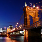
Guest jmecklenborg Posted July 25, 2019 Share Posted July 25, 2019 ^Good job running a photo of two bridges - neither of which are the bridge being discussed. But this is great news. It'll bring a lot of new foot and bicycle traffic to the top of the levee near BB Riverboats, where you currently have to either climb or walk down a ton of steps. Link to comment Share on other sites More sharing options...
jwulsin Posted July 26, 2019 Share Posted July 26, 2019 ^^11.5 miles is awesome. Is there a map showing where the trail will run? How much is already in place? Will the entire 11.5 miles be grade-separated? Link to comment Share on other sites More sharing options...
jwulsin Posted July 26, 2019 Share Posted July 26, 2019 I found this map, but not sure how up-to-date it is, since it still shows portions under "2017 construction": http://nkyriverfrontcommons.com/index.html?appid=8e0658ec1fe74c6eb656180a9a7aab9a The articles made it sound like the bridges are the only remaining pieces, but in fact most of the trail hasn't been built yet. I wish the articles would be cleared about what is currently built and when future portions will be completed. Link to comment Share on other sites More sharing options...
Guest jmecklenborg Posted July 26, 2019 Share Posted July 26, 2019 There are so many expensive needs to complete the riverside trail that pictured here that I don't know where to start. It's a mess! . Link to comment Share on other sites More sharing options...
cincybiker Posted August 14, 2019 Share Posted August 14, 2019 (edited) Looks like US 52 in eastern Hamilton County and Clermont county is getting bike lane markings on the shoulder. I noticed it this morning on my way to work. Right now they have temp markings about 2'-0" inside the shoulder for another line and slashes. Also "bike" with an arrow was hand spray painted onto the shoulder in various spots. looks like it will go all the way to the Kellogg exit off of 52 in both directions to New Richmond Edited August 14, 2019 by cincybiker Link to comment Share on other sites More sharing options...
Guest jmecklenborg Posted September 21, 2019 Share Posted September 21, 2019 I made this video of a 1-day Cincinnati>Columbus ride 10 years ago this month: This was before GoPro, so the quality is startlingly bad compared to what we're used to now. I think the original file was a bit better so maybe I'll try to re-upload it if vimeo/youtube now allow larger file sizes. Link to comment Share on other sites More sharing options...
jjakucyk Posted October 4, 2019 Share Posted October 4, 2019 Temporary striping of the bike lanes on Montgomery Road through Pleasant Ridge and Kennedy Heights is in while they're working on repaving. It's a bit disappointing how long the non-bike-lane section is through the middle of Pleasant Ridge, from Langdon Farm to Grand Vista. There's a center turn lane and two lanes each way in that stretch, with parking allowed in the curb lane during off-peak hours. Overall a weak implementation, but better than it was, which was nothing. It's kind of astounding that they had a 6-lane cross section with only 50' of pavement. If it was 55' wide then they could've done it like Delta. https://www.cincinnati-oh.gov/dote/dote-projects/montgomery-road-safety-project/ Link to comment Share on other sites More sharing options...
Guest jmecklenborg Posted January 24, 2020 Share Posted January 24, 2020 A new approach to the world-famous bike trail will be built in Marriemont. It'll b about 1/2 mile long but will allow you to avoid the traffic around the Newtown bridge. https://www.wcpo.com/entertainment/local-a-e/fifty-west-brewing-hamilton-county-parks-announce-little-miami-trail-expansion Link to comment Share on other sites More sharing options...
jjakucyk Posted January 24, 2020 Share Posted January 24, 2020 They have a plan in place to get from Newtown Road to Mariemont High School (taking over and expanding an existing sidewalk from McDonalds up to Pocahontas or thereabouts. That will be quite a benefit. I routinely do a 37 mile loop from Hyde Park up to Loveland and then back via the bike path, and the climb up Wooster Pike from 50W to Mariemont is the worst part of it. Link to comment Share on other sites More sharing options...
Guest jmecklenborg Posted January 25, 2020 Share Posted January 25, 2020 Yeah that hill is a little annoying, especially after a really long ride. I haven't done the Erie Ave. hill in a few years but that one sucks too if you're already worn out. One time I rode from Columbus to Cincinnati in one day and about 11-12 hours into the ride, right after that hill, what's going on in Hyde Park Square? that's right, some sort of bicycling event. I coasted through that thing around mile 120! Link to comment Share on other sites More sharing options...
jjakucyk Posted January 25, 2020 Share Posted January 25, 2020 I have to do both Wooster and Erie, but the problem with Wooster is the fast moving traffic and for whatever reason going up the hill by McDonalds motorists really ride your ass, probably because they know the left lane is ending up ahead. Erie is no big deal in comparison, except at the Redbank overpass which is kind of sketchy. Link to comment Share on other sites More sharing options...
Guest jmecklenborg Posted January 25, 2020 Share Posted January 25, 2020 Yeah I never thought about it before but I agree that Erie is always pretty laid back compared to Wooster. I've done Madison Rd. all the way out to the bike trail a few times too and it's pretty low-key. The fact is that the Murray Ave. bike trail isn't a hidden gem or anything - it's just there - so it's not enough of an improvement to be the automatic choice for heading to the trail. Speaking of hidden gems - the Milford mountain bike trail is small but surprisingly fun. It's totally different than any other mountain bike trail in the area. I like to hit it for maybe a half hour and then get back in the car and go to East Fork. Link to comment Share on other sites More sharing options...
Guest jmecklenborg Posted January 29, 2020 Share Posted January 29, 2020 On Sunday I rode my bike to the Mt. Airy mtb trail, then hiked to see the new construction since the trail itself was closed to bikes due to muddy conditions. I don't think the guys who designed and built this trail predicted the reality that now exists. The first section, dubbed Creamy Whip, is on the west side of the ridge, facing I-74 and the setting sun, and it dries out quickly. Last summer I recall riding just 2-3 hours after a heavy downpour. The new section is on the east face of that ridge, overlooking the west fork of the Mill Creek and West Fork Rd., and it receives just a few minutes of direct sunshine each day so it's staying wet and unrideable for weeks on end. That section has been extended by maybe a mile since last summer and now almost reaches the promised north parking lot. It climbs all the way to the top of the ridge via a new switchback...and into the sunshine. So the trail network has entered into a situation unique to area mountain bike trails where one half of the system dries out completely days before the other half. I mean, the drainage for about 1,000 feet of the new trail is...terrible. It needs one of those wooden plank features...like 1,000 board-feet. I was really hoping for something in Mt. Airy as appealing as the Urban Wilderness in Knoxville, which is a trail network that appeals to all types of bikers. Instead, you can only show up to Mt. Airy with a full tank of gas knowing that in 45 minutes you're going to be done for the day. It's literally the only place I've ridden where I'm gasping for air on climbs like a smoker. Tower Park will always be profoundly primitive AND most dangerous mtb trail in the region, but Mt. Airy is unnecessarily difficult. There's like no let-up from the second you pass through the gate. Link to comment Share on other sites More sharing options...
cincybiker Posted January 29, 2020 Share Posted January 29, 2020 On 1/25/2020 at 12:17 PM, jmecklenborg said: Speaking of hidden gems - the Milford mountain bike trail is small but surprisingly fun. It's totally different than any other mountain bike trail in the area. I like to hit it for maybe a half hour and then get back in the car and go to East Fork. Where is this Milford MTB trail you speak of? I always go to east fork but would like to try something different Thanks Link to comment Share on other sites More sharing options...
Guest jmecklenborg Posted January 29, 2020 Share Posted January 29, 2020 22 minutes ago, cincybiker said: Where is this Milford MTB trail you speak of? I always go to east fork but would like to try something different Thanks It's on this tiny wooded flood plain: https://www.google.com/maps/place/Milford,+OH/@39.1681268,-84.2989504,647m/data=!3m1!1e3!4m5!3m4!1s0x884105dae0ace003:0x6294730405ff87b0!8m2!3d39.1753377!4d-84.2943821 The trees are huge and there are old railroad trestle piers in the middle of the woods. In parts you get to ride on rounded river rocks and types of gravel that don't exist in other mtb trails. It's also completely level, so you can ride as hard or laid back as you want. Apparently there is another short section on the other side of the Little Miami but I have never looked for it. Link to comment Share on other sites More sharing options...
Chas Wiederhold Posted January 30, 2020 Share Posted January 30, 2020 On 1/24/2020 at 5:50 PM, jjakucyk said: They have a plan in place to get from Newtown Road to Mariemont High School (taking over and expanding an existing sidewalk from McDonalds up to Pocahontas or thereabouts. That will be quite a benefit. I routinely do a 37 mile loop from Hyde Park up to Loveland and then back via the bike path, and the climb up Wooster Pike from 50W to Mariemont is the worst part of it. How does the path extension connect to the sidewalk expansion through the Kroger lot? Would it happen behind the building? Would you bike on the sidewalk from Pocahontas? Link to comment Share on other sites More sharing options...
jjakucyk Posted January 30, 2020 Share Posted January 30, 2020 It goes behind Kroger then up Miami Run to Wooster, and along Wooster either to Pocahontas or something with the new High School entrance. That's the end of the project at this point if I recall, but once you get to Pocahontas then you have easy streets to ride on. Link to comment Share on other sites More sharing options...
ColDayMan Posted March 2, 2020 Share Posted March 2, 2020 Red Bike set to open Findlay Market one-stop shop Red Bike will roll out its one-stop-shop inside Findlay Market this week. The nonprofit bikeshare system’s Red Bike Market Center, at 1801 Race St., will serve as the hub for its Red Bike Go program that offers affordable memberships to low-income riders. Visitors will be able to sign up for Red Bike Go, renew memberships, make cash payments and ask questions. The space will also serve as an information desk for Findlay Market shoppers with details about vendors as well as the surrounding Market District and Findlay Market merchandise available for purchase. More below: https://www.bizjournals.com/cincinnati/news/2020/03/02/red-bike-set-to-open-findlay-market-one-stop-shop.html "You don't just walk into a bar and mix it up by calling a girl fat" - buildingcincinnati speaking about new forumers Link to comment Share on other sites More sharing options...
Guest jmecklenborg Posted March 30, 2020 Share Posted March 30, 2020 Red Bike has been shut down indefinitely: https://www.fox19.com/2020/03/30/red-bike-shut-down-slow-spread-virus/ Link to comment Share on other sites More sharing options...
Guest jmecklenborg Posted March 30, 2020 Share Posted March 30, 2020 The Mt. Airy mountain bike trail was recently completed northward to Shepherd Creek Rd. The trail now has two completely separate parking areas and trail heads, which is entirely unique in this area. Both parking areas predated the mountain bike trail but almost zero-body hiked this area since the E trail was not well-maintained. I believe that most people will come to ride this trail network from north to south because the north trailhead is 100+ feet in elevation higher than the south. This past weekend I did a "shuttle" back up to the north trailhead on West Fork Rd. and I believe this will become common in the future because the climbing near the south trailhead is ridiculous. The new north trailhead: https://www.google.com/maps/@39.1704666,-84.5806792,212m/data=!3m1!1e3 The original south trailhead: https://www.google.com/maps/@39.1626909,-84.5724333,116m/data=!3m1!1e3 Unfortunately the drainage situation on the new trail extension is terrible. It never, ever gets direct sunlight and so takes WEEKS to dry out. I am skeptical that it will be usable for more than 100 days out of the 365-day year. They're going to have to build another trail on the I-74 side of the ridge that gets much more direct sunlight and dries out quickly, as does the original Creamy Whip trail. There is an old drinking fountain at the south trailhead. This is a pretty significant feature for a small trail network, since several of the larger networks like Devou have no water source. Link to comment Share on other sites More sharing options...
taestell Posted March 30, 2020 Share Posted March 30, 2020 14 hours ago, jmecklenborg said: Red Bike has been shut down indefinitely: https://www.fox19.com/2020/03/30/red-bike-shut-down-slow-spread-virus/ Cincinnati is shutting down the streetcar, Red Bike, and scooters for the duration of the pandemic. Link to comment Share on other sites More sharing options...
Guest jmecklenborg Posted April 4, 2020 Share Posted April 4, 2020 Blue Ash bike share is SHUT DOWN: Link to comment Share on other sites More sharing options...
Guest jmecklenborg Posted May 7, 2020 Share Posted May 7, 2020 Construction of the Little Miami trail fork behind 50 West is underway: Also, on a ride today I saw a girl walking her cat on the trail near Loveland: Pretty much any time you ride the path near Loveland you see something pretty weird. Link to comment Share on other sites More sharing options...
GCrites Posted May 7, 2020 Share Posted May 7, 2020 On 3/30/2020 at 2:00 AM, jmecklenborg said: The Mt. Airy mountain bike trail was recently completed northward to Shepherd Creek Rd. The trail now has two completely separate parking areas and trail heads, which is entirely unique in this area. Both parking areas predated the mountain bike trail but almost zero-body hiked this area since the E trail was not well-maintained. I believe that most people will come to ride this trail network from north to south because the north trailhead is 100+ feet in elevation higher than the south. This past weekend I did a "shuttle" back up to the north trailhead on West Fork Rd. and I believe this will become common in the future because the climbing near the south trailhead is ridiculous. The new north trailhead: https://www.google.com/maps/@39.1704666,-84.5806792,212m/data=!3m1!1e3 The original south trailhead: https://www.google.com/maps/@39.1626909,-84.5724333,116m/data=!3m1!1e3 Unfortunately the drainage situation on the new trail extension is terrible. It never, ever gets direct sunlight and so takes WEEKS to dry out. I am skeptical that it will be usable for more than 100 days out of the 365-day year. They're going to have to build another trail on the I-74 side of the ridge that gets much more direct sunlight and dries out quickly, as does the original Creamy Whip trail. There is an old drinking fountain at the south trailhead. This is a pretty significant feature for a small trail network, since several of the larger networks like Devou have no water source. This is just something we have to deal with in Ohio. If something has hills they are covered in trees. If it's flat and gets sun it's tilled for farming, is a flood plain or gets developed. The kind of moonscapes that are perfect for riding seen out west don't exist here. There is a large old strip mine north of Zanesville like that. Link to comment Share on other sites More sharing options...
Guest jmecklenborg Posted May 7, 2020 Share Posted May 7, 2020 26 minutes ago, GCrites80s said: This is just something we have to deal with in Ohio. If something has hills they are covered in trees. If it's flat and gets sun it's tilled for farming, is a flood plain or gets developed. The kind of moonscapes that are perfect for riding seen out west don't exist here. There is a large old strip mine north of Zanesville like that. The guys put a lot of work into the trail in early April, soon after I wrote that post. They dug gutters on the uphill side of terraced trail sections and mounded up the trail itself along several hundred feet of trail. In the worst spots they moved many flat rocks into position, almost like a rock bridge across a pond. They have solved pretty much all of the problems that existed before, but it took a ton of physical work to make it happen. That said, as it exists today, Mt. Airy is the most difficult mountain bike trail in the area. There is almost no respite from either aggressive climbing or aggressive descending anywhere along its current three miles. Your heart rate maxes out within a minute of entering at either entrance and isn't going to drop below 120 unless you sit down and take a break. Link to comment Share on other sites More sharing options...
mkeller234 Posted May 7, 2020 Share Posted May 7, 2020 (edited) On 6/25/2019 at 5:06 PM, taestell said: Even if a shared path alongside the street is the better option, is it worth spending 3 times as much as the protected bike lanes that were originally planned? That's a perfect way to make sure the city makes as little progress on bike infrastructure as possible... blow the budget on a few fancy trails instead of putting down some paint and bollards for a fraction of the cost and building a much larger network. I can say in Canton, the city engineer secures federal funding by making "complete streets", meaning they have some form of bike path included. I know it's been a key in some of our main corridors, Cherry Avenue, 12th street etc. Without the inclusion of the bike paths, the funding would not be available and the project would be dead. It's gotten some pretty poor looking roads and corridors spiffed up. I commute on the bike lines on 12th, which I probably would not ride on without them. Maybe the same thing is happening with a project like the one you mentioned.? Edited May 7, 2020 by mkeller234 Link to comment Share on other sites More sharing options...
Guest jmecklenborg Posted May 9, 2020 Share Posted May 9, 2020 The mtb trail conditions today are pretty typical of the pattern we see around here - Mitchell Memorial is my favorite trail in the area but it has serious drainage issues and I don't hesitate to say is outright dangerous to ride when it's wet. Meanwhile, thanks to hundreds of hours of manual labor, Mt. Airy went from worst to first for drainage. That doesn't change the fact that it's a short but extremely challenging trail thanks to the most and steepest climbing in the area. At Devou, the entrance is what I thought was a pretty substantial climb until Mt. Airy opened. It's a solid 10 minutes of climbing before the ride even starts, but none of it is insanely steep. Devou does have a very steep climb at the back of Back Bowl but all of Mt. Airy is like that. Link to comment Share on other sites More sharing options...
Guest jmecklenborg Posted May 14, 2020 Share Posted May 14, 2020 Construction of the Ohio River trail between Lunken Airport and Coney Island/Belterra Park is underway. Today I saw no less than 50 guys working at 3 different construction sites. Some of the work they are doing is very expensive. About 2-3 miles of the trail opened more than 10 years ago from Coney Island east to a random gas station. What is under construction currently will link that section to the heavily used Lunken Airport trail. What is being built won't be perfect but it will be a vast improvement over the current situation. The hilly curve at the Cincinnati Waterworks has always been a dangerous spot but that's about to end. In these photos you will see why this trail extension is so expensive - they're moving many, many telephone poles and a few sewers. They're also build a pair of very large retaining walls near the Waterworks. Link to comment Share on other sites More sharing options...
shawk Posted May 14, 2020 Share Posted May 14, 2020 ^ thanks for that update, I was actually just looking into the ORT last weekend and wondered what the status was since the site for the Salem to Sutton connection you described said construction would begin fall 2019. I also saw public comment going around from ODOT for the Lunken to LMST bridge which is expected to begin construction next spring and be complete 2022. Has the section from Lunken to downtown been funded or have a timeline? Link to comment Share on other sites More sharing options...
GCrites Posted May 14, 2020 Share Posted May 14, 2020 Bills for paved bike/mixed use paths are gigantic as compared to unpaved. Link to comment Share on other sites More sharing options...
Guest jmecklenborg Posted May 17, 2020 Share Posted May 17, 2020 Wild...from what I'm hearing elsewhere, walkers and bikers will be forced to head down to the traffic circle in order to cross the bridge approach. Hopefully that information is incorrect, since a new traffic signal in this location would help reduce the speeding by motorcyclists. A trip down and around the traffic circle is no less than 1,700 feet, or roughly the length of the bridge itself north to U.S. Bank Heritage Bank Arena. Link to comment Share on other sites More sharing options...
ucgrady Posted May 19, 2020 Share Posted May 19, 2020 That makes absolutely no sense. Why not just do a crosswalk with flashing yellow lights and cut a couple new openings in the concrete walls? I would love to see a raised walk/hump just inside the big expansion joint where the bridge begins, but even just paint and lights would be better than nothing. I get that if you are walking/biking on the levee wall and want to get to Ohio, it's really annoying to go down and around and up some stairs, and this will help with that. But I thought these two bridges were also part of creating the overall connectivity of the Riverfront Commons project, which can only be accomplished with a crosswalk. Link to comment Share on other sites More sharing options...
JYP Posted May 19, 2020 Share Posted May 19, 2020 Here's how they describe it on the Southbank Partners Site: http://www.southbankpartners.com/news/2019/11/21/three-riverfront-projects-bring-riverfront-commons-closer-to-reality-.aspx Quote Pedestrian walkways to Taylor-Southgate Bridge in Newport In Newport, construction is currently underway on two pedestrian walkways that will connect Riverfront Commons to the sidewalks on east and west side of the Taylor-Southgate Bridge. Sunesis Construction is currently working on the $1.2-million project. The Riverfront Commons trail section in Newport was one of first full sections of the trail to be completed. The Newport trail runs from on top of the riverfront levee from the Fourth Street bridge to Bellevue and it connects with the Purple People Bridge via pedestrian walkways. However, people on the trail who want to use the Taylor- Southgate Bridge, a popular route for Reds games and other event and activities in Cincinnati and Newport, must now descend the trail by steps to the roadway below, cross the street, then ascend an additional set of steps up to the bridge level. “The new pedestrian walkways will make it much more convenient for walkers, runners, and bikers to access the Taylor-Southgate Bridge,” Newport City Manager Tom Fromme said. “These new walkways, along with existing pedestrian connections at the Purple People Bridge, will make our community even more walkable than it already is.” Newport Mayor Jerry Peluso said the project is important for not only Newport but also for people who live and work in Cincinnati. “These new walkways, which people have been requesting for a long time, will not only benefit our residents and visitors, but they also will make it even easier for people in Cincinnati to visit our community and enjoy the entertainment, recreation, music, delicious food, and beautiful panoramic views found here,” Peluso said. “All truly great thoughts are conceived while walking.” -Friedrich Nietzsche Link to comment Share on other sites More sharing options...
Guest jmecklenborg Posted May 19, 2020 Share Posted May 19, 2020 28 minutes ago, ucgrady said: That makes absolutely no sense. These bridges don't make sense and neither does the new road layout. The Newport Riverfront has gone from being mediocre in one way to being mediocre in another. The traffic circles are the two worst new traffic circles in the region. Both are terrible for pedestrians. The weird "bypass" connecting them is...weird. Link to comment Share on other sites More sharing options...
GCrites Posted May 19, 2020 Share Posted May 19, 2020 (edited) ^NKY (Kenton, Boone and Campbell County) traffic engineering over the past 50 years has for the most part been way off the mark and wacky. So many unnecessary/overbuilt projects and closures. And all those one-ways put them out of business. They just can't figure it out. A lot of these changes have been documented by this website: http://www.bunkerblast.info/roadpics/ Edited May 19, 2020 by GCrites80s Link to comment Share on other sites More sharing options...
taestell Posted May 19, 2020 Share Posted May 19, 2020 Looks like the perfect location for some guerrilla urbanists to paint a crosswalk and put one of those "stop for pedestrians in crosswalk" bollards in the middle. 2 Link to comment Share on other sites More sharing options...
ColDayMan Posted May 29, 2020 Share Posted May 29, 2020 Red Bike reopens with more e-bikes, first responders initiative Cincinnati’s nonprofit bike sharing program is back in business after a two-month hiatus. Mayor John Cranley announced Thursday afternoon that Red Bike has reopenedafter it shut down on March 29 due to coronavirus concerns. Red Bike submitted to the Cincinnati Health Department a detailed reopening plan that prioritizes the health and safety of Red Bike riders, staff and the community. As it reopens, Red Bike will launch Bike It Forward, an initiative that will give free monthly Red Bike “Thank You” memberships to health care workers and first responders. The initiative will also provide free advertising space on Red Bikes and station kiosks for local restaurants and bars to help promote the businesses that have been hard hit by the pandemic. More below: https://www.bizjournals.com/cincinnati/news/2020/05/28/red-bike-reopens-with-more-bikes-new-intiative.html "You don't just walk into a bar and mix it up by calling a girl fat" - buildingcincinnati speaking about new forumers Link to comment Share on other sites More sharing options...
Guest jmecklenborg Posted June 1, 2020 Share Posted June 1, 2020 The CPD mountain bikes were out in full force this past weekend. It was interesting to see many of the officers wearing downhill mtb full-face helmets and...shin guards. Also...they weren't using the bike lane: Link to comment Share on other sites More sharing options...
jwulsin Posted June 30, 2020 Share Posted June 30, 2020 This is kind of a niche question, and I know it's not exactly the purpose of this thread... but I'm wondering if anybody has biked across Western Hills Viaduct, either on the top or lower level. I'm asking because Google Maps recommends it (the lower level) as the preferred bike route from OTR to Fairmount. Alternatively, I could bike up to Hopple or down to Gest... but those add 1 or 2 miles, respectively. I'm fairly comfortable riding in traffic... but the Western Hills Viaduct seems extremely hostile. There's a sidewalk on the southern side of the upper deck. I usually wouldn't bike on a sidewalk, but that seems like it might be the only reasonably safe way to bike across the Viaduct. Link to comment Share on other sites More sharing options...
10albersa Posted June 30, 2020 Share Posted June 30, 2020 I haven't. I may attempt when the Lick Run trail is done. Based on a quickly Google Maps peek, I'd take the top deck. Westward, take your pick, but the lower deck is only 1 lane eastbound, and I'm not willing to take a one lane narrow road with some of the crazies that drive over that thing waiting behind me. 1 Link to comment Share on other sites More sharing options...
jwulsin Posted June 30, 2020 Share Posted June 30, 2020 18 minutes ago, 10albersa said: I haven't. I may attempt when the Lick Run trail is done. Based on a quickly Google Maps peek, I'd take the top deck. Westward, take your pick, but the lower deck is only 1 lane eastbound, and I'm not willing to take a one lane narrow road with some of the crazies that drive over that thing waiting behind me. Thanks - the Lick Run trail is looking good. They definitely still have work left to be completed, but I think they're on target to finish by end of year. Link to comment Share on other sites More sharing options...
Guest jmecklenborg Posted June 30, 2020 Share Posted June 30, 2020 (edited) The upper deck has a sidewalk. The lower deck does not. You have to carry your bike up or down a staircase at the west end unless you want to get out in the scrum. The sidewalk is fairly narrow so if you encounter another bike or pedestrian one of you needs to step off the sidewalk. It's not a big deal. There is usually a fair amount of broken glass on the sidewalk as well. Edited June 30, 2020 by jmecklenborg Link to comment Share on other sites More sharing options...
Ram23 Posted June 30, 2020 Share Posted June 30, 2020 1 hour ago, jwulsin said: This is kind of a niche question, and I know it's not exactly the purpose of this thread... but I'm wondering if anybody has biked across Western Hills Viaduct, either on the top or lower level. I'm asking because Google Maps recommends it (the lower level) as the preferred bike route from OTR to Fairmount. Alternatively, I could bike up to Hopple or down to Gest... but those add 1 or 2 miles, respectively. I'm fairly comfortable riding in traffic... but the Western Hills Viaduct seems extremely hostile. There's a sidewalk on the southern side of the upper deck. I usually wouldn't bike on a sidewalk, but that seems like it might be the only reasonably safe way to bike across the Viaduct. I've walked across that sidewalk before and it can be nerve-racking. It's pretty narrow, so truck/bus mirrors are mere inches from you, and everyone seems to be doing 20+ MPH over the speed limit at all times. Also note that it dumps you into a stairway on the west side of the bridge. Link to comment Share on other sites More sharing options...
jwulsin Posted June 30, 2020 Share Posted June 30, 2020 Ugh... hadn't realized about that bad termination on the west side. Thanks for the info! Link to comment Share on other sites More sharing options...
jjakucyk Posted June 30, 2020 Share Posted June 30, 2020 I've biked some pretty unfriendly streets, but never Western Hills Viaduct or Hopple. I've only done 8th, Gest, and Millcreek. I don't have any need or desire to go that way though. Usually I'm coming down Spring Grove or Central Parkway. If I want to mix things up, I'll take Millcreek to State/Beekman and then head back east on 8th or Gest. There's just not much good riding on the west side, and even if there were, crossing the Mill Creek Valley is only the first challenge, then you have to get up the hill and not a single one of the roads is good for that. Link to comment Share on other sites More sharing options...
Guest jmecklenborg Posted June 30, 2020 Share Posted June 30, 2020 1 hour ago, jjakucyk said: There's just not much good riding on the west side A good ride from downtown is to go up Warsaw then out on Cleves-Warsaw to Cleves, then up E. Miami River Rd. to New Baltimore, then back toward town via Blue Rock Rd., then over to West Fork Rd. via Sheed, then back to Northside via West Fork Rd. A variation is to ride Hillside instead of Cleves-Warsaw and to divert from E. Miami River Rd. to Buffalo Ridge (there is a water fountain and bathrooms in Mitchell Memorial Forest). Aside from Buffalo Ridge, biking the big hills on Rybolt and Race Rd. are fun on occasion, and the steep Springdale Rd. climb up from Harrison is fun. There are other big hills that come off of Springdale outward toward Butler County like Brehm and Thompson Rd. I have ridden from Clifton to Harrison (the whole length of Harrison Rd.) and back before. The only section that sucks is from about I-74 to Miamitown. You just need to conserve energy so you can blast through that section at 22~mph to get it over as soon as possible. It's one of the more bike-hostile spots in Cincinnati. Another ride that I have done is from downtown to Miami-Whitewater Forest, do a lap of that 8-mile paved trail, then head back. Link to comment Share on other sites More sharing options...
jwulsin Posted July 1, 2020 Share Posted July 1, 2020 On my way to Fairmount, I took Gest to State, and on the way back I took the upper deck of the Viaduct. I survived, but the Viaduct is definitely not good for biking. Traffic wasn't too bad, so cars could easily pass me... but I was worried one car would pass me and then have the car behind not see me. I think in the future, I'll just take Gest/State route, even though it's quite a bit longer. Link to comment Share on other sites More sharing options...
Guest jmecklenborg Posted July 18, 2020 Share Posted July 18, 2020 Someone stole my fairly expensive road bike right off my porch last night right after I got home while I was inside feeding my cat. Amazingly it turned up on a sidewalk in Mt. Auburn early Saturday morning. It's unharmed and was in the toughest gear...obviously the knucklehead who stole it only sort-of figured out how to change the gears and got stuck in the hardest one. Also, they didn't have clip-in shoes, so it was tough going for that reason alone. I'd bet that they walked it up Milton St. and got tired of pushing it. Link to comment Share on other sites More sharing options...

Recommended Posts
Create an account or sign in to comment
You need to be a member in order to leave a comment
Create an account
Sign up for a new account in our community. It's easy!
Register a new accountSign in
Already have an account? Sign in here.
Sign In Now